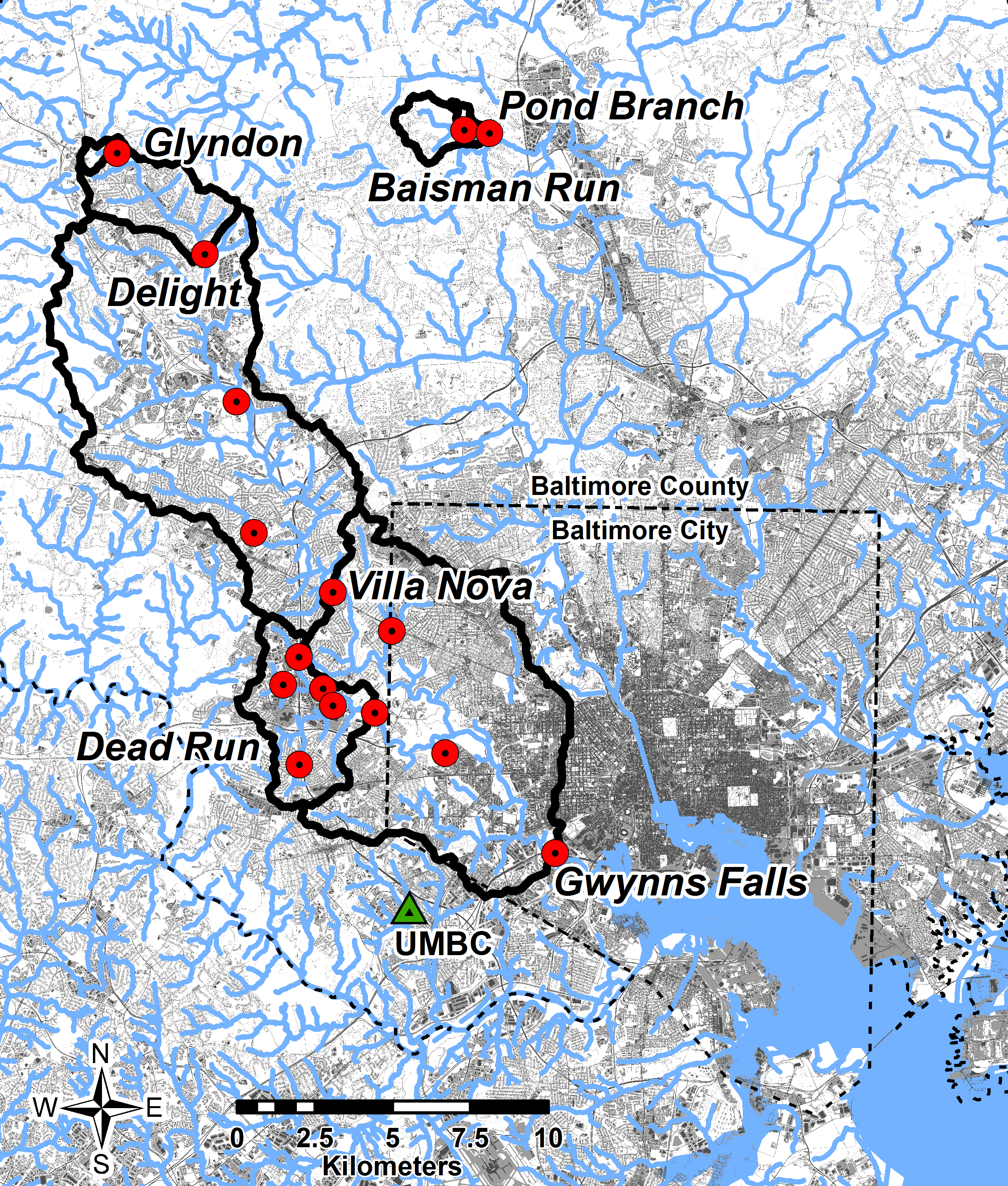
Gwynns Falls watershed, with impervious surface area shown in gray scale. Red dots indicate location of USGS stream gaging stations.
Citation: Lagrosa, John J. IV. 2017. Gwynns Falls watershed, impervious surface area and USGS stream gaging stations. Center for Urban Environmental Research and Education, UMBC, Baltimore, MD. https://cuere.umbc.edu/maps/gwynns_falls/